TerraClear, a company previously celebrated for its heavy-duty rock-picking robotics, is officially pivoting to the software layer of precision agriculture. Their latest innovation, a high-resolution commercial weed mapping platform, promises to solve one of the industry’s most persistent headaches: inefficient herbicide application. By leveraging advanced artificial intelligence and high-fidelity imagery, the platform can now identify weeds as small as a quarter-inch, a metric that effectively bridges the gap between general field management and surgical, plant-level precision. This technological leap signals a definitive shift toward automated, site-specific weed management (SSWM) that could fundamentally alter the economics of corn and soybean production while setting a new standard for high-value specialty crops like cannabis.
Key Highlights
- Unprecedented Resolution: TerraClear’s platform identifies weeds down to a quarter-inch, allowing sprayers to differentiate between crop and threat with surgical accuracy.
- Reduced Input Costs: By shifting from blanket spraying to precise, spot-based herbicide application, farmers can potentially reduce chemical usage by significant margins, improving ROI.
- Versatile Application: While launched for corn and soybean giants, the underlying AI architecture is highly transferable to precision-demanding cannabis and specialty hemp cultivation.
- Data-Driven Farming: The system creates a comprehensive, geo-referenced map that serves as a digital twin for field weed pressure.
The Engineering of Precision: How TerraClear Disrupts Weed Control
The fundamental challenge in modern weed control has never been the efficacy of the chemicals themselves, but the deployment strategy. Historically, farmers have relied on blanket spraying—applying herbicides across entire acreage regardless of whether a specific square foot was infested. This ‘brute force’ approach is not only environmentally questionable but economically wasteful. TerraClear is changing this paradigm by moving the decision-making process from the driver’s seat to the cloud.
From Satellite Data to Row-Level AI
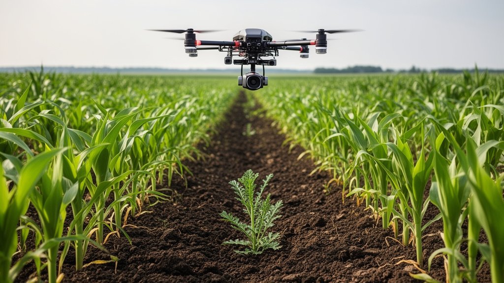
Unlike traditional agricultural drones that provide general canopy health metrics, TerraClear’s new platform utilizes a multi-layered computer vision stack. The system processes high-resolution imagery captured during pre-season or mid-season passes, utilizing convolutional neural networks (CNNs) trained specifically to distinguish between the morphological characteristics of emerging soybeans or corn stalks and common, broadleaf, or grassy weed varieties.
This is not merely identifying large clusters of weeds; it is isolating individual entities. By reaching the quarter-inch detection threshold, the software provides a ‘weed map’ that can be uploaded directly into the sprayer’s guidance system. The sprayer, equipped with individual nozzle control, only activates when it crosses a verified weed coordinate. The engineering feat here lies in the latency management—ensuring that the map’s coordinate system aligns perfectly with the mechanical response time of the sprayer’s boom at typical tractor operating speeds.
The Engineering behind Quarter-Inch Accuracy
Achieving quarter-inch detection requires a sophisticated synthesis of sensor fusion and machine learning. TerraClear’s platform integrates high-density imagery with precise GPS-RTK (Real-Time Kinematic) data. The AI does not just ‘see’ a weed; it understands the spatial relationship between the weed and the crop row. This is vital because, in early growth stages, the visual difference between a sprout and a weed can be negligible to standard cameras. By focusing on leaf shape, texture, and growth patterns, the AI minimizes false positives—a critical necessity in commercial settings where accidentally spraying a crop can reduce yield just as effectively as the weeds themselves.
Environmental and Economic Implications for Modern Farming
When we analyze the transition from blanket application to targeted, data-backed spraying, the environmental and economic outcomes are profound. For the commercial farmer, this is no longer about sustainability as a branding exercise; it is about input optimization as a survival mechanism.
Reducing Herbicide Over-Application
The agricultural industry has faced increasing pressure to reduce the runoff of chemicals like glyphosate and dicamba into water tables. TerraClear’s mapping platform provides the data layer necessary to comply with tightening regulations without sacrificing crop protection. By eliminating the ‘spray and pray’ model, farms can reduce herbicide usage by an estimated 60% to 80% depending on the initial weed pressure. This reduction isn’t just a win for the environment; it is a direct line-item cost saving. In years where chemical prices are volatile, saving 70% on herbicide input costs can be the difference between a profitable harvest and a break-even season.
Scaling ROI through Intelligent Spraying
The integration of this software into existing sprayer architecture represents a ‘plug-and-play’ revolution. Farmers do not need to replace their entire fleet of machinery. Instead, they upgrade the brains of their operation. By utilizing TerraClear’s mapping, growers can justify the cost of the digital subscription through the immediate reduction in chemical spend. Furthermore, the granular data generated by the mapping process serves a dual purpose: it acts as a historical record for long-term field health management. By tracking weed pressure changes over several seasons, farmers can adjust their planting density and rotation strategies, further maximizing the productive output of every acre.
Future Horizons: Cannabis Cultivation and Beyond
While TerraClear’s headline launch targets the massive corn and soybean markets, the potential for this technology in specialty crops—most notably cannabis and hemp—is immense. Cannabis is notoriously labor-intensive, and because these crops are often grown in high-value, controlled environments or large-scale plots where individual plant health is paramount, weed control has traditionally been a manual, costly endeavor.
Transferability of Precision AI
Cannabis cultivation presents unique challenges: the need for incredibly high purity, the sensitivity of the plants to herbicides, and the high-value nature of the crop. TerraClear’s quarter-inch detection is tailor-made for this environment. If an AI can distinguish a weed from a corn sprout, it can certainly be trained to identify invasive flora within a cannabis row. The shift toward automated weed control in the cannabis sector would radically reduce labor costs—which often account for a massive percentage of cultivation overhead—and significantly decrease the reliance on hand-weeding crews.
The Broader Agricultural Ecosystem
As TerraClear expands its software-first approach, we are likely to see the emergence of a ‘digital farm’ ecosystem where the sprayer is just one of many implements that ‘talk’ to the central map. Fertilizer applicators, seed drills, and even harvesting equipment could eventually use the same geo-spatial weed maps to optimize their specific tasks. We are witnessing the maturation of ag-tech from a novelty sector into a critical infrastructure component, where data fidelity is as valuable as the soil itself.
FAQ: People Also Ask
1. How does quarter-inch resolution change sprayer efficiency?
It changes the mode of operation from ‘area-based’ to ‘event-based.’ Instead of spraying a continuous swath, the system sends a trigger signal only when the sprayer nozzle is precisely positioned over a identified weed coordinate, resulting in near-total elimination of wasted chemical application in non-infested zones.
2. Is this technology limited to corn and soybeans?
While the current platform is optimized for the row structures and weed types common in corn and soybean fields, the underlying AI models are extensible. TerraClear has designed the software to be adaptable to various crop architectures, including row-planted high-value specialty crops.
3. How does this compare to traditional spray methods?
Traditional methods treat fields as a homogenous surface, often spraying the entire field to target localized weeds. TerraClear’s approach treats the field as a dynamic, heterogenous map, applying resources only where required, which reduces chemical volume, protects soil integrity, and lowers input costs.
4. Do farmers need new hardware to use the mapping system?
Generally, no. The mapping platform integrates with existing GPS-enabled sprayer controllers. The key investment is the software subscription and the initial high-resolution mapping pass, which can be done via drone or specialized ground-rig cameras.